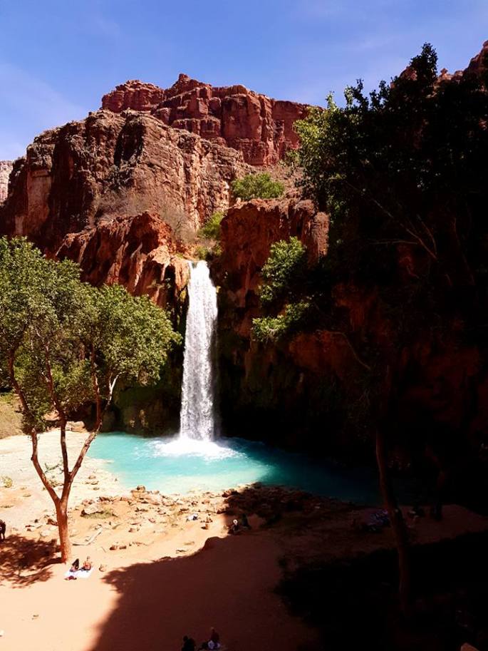
With the advent of Instagram, so many more amazing places have come to the forefront of my travel world. Havasupai Falls is one of the most photogenic and magical looking places to flash across my screen recently and I knew I had to visit.
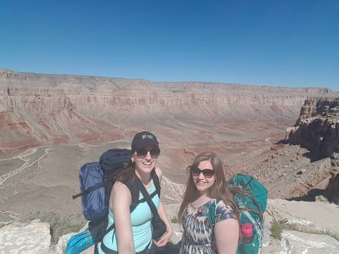
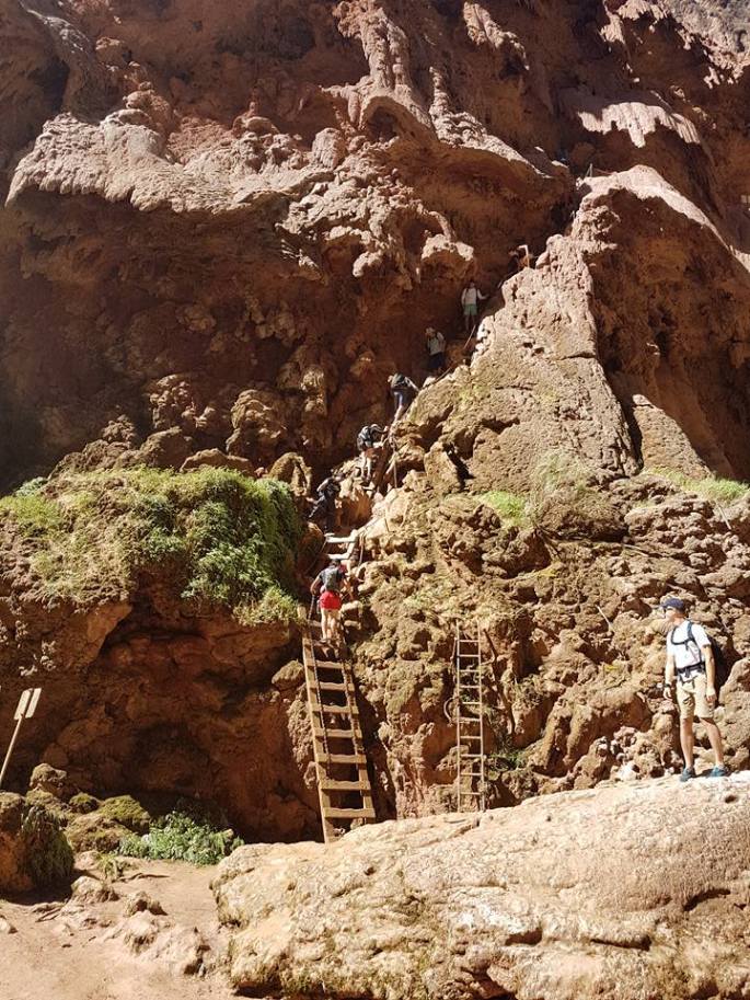
Shiny, clean faces, setting out for our big hike in! The hike follows the trail you can kind of see snaking down the canyon to the right.
Getting There:
Unfortunately, it is SUPER hard to get a reservation to visit Havasupai. Prior to this year, the only way to get a reservation was by telephone. They opened an online reservation system this year, however, after just a short while, it was put on hold due to overwhelming requests. In February, I called the four different numbers I could find listed for the reservation office, the camping office, and so on probably twenty to thirty times and it rang endlessly or cut out until finally someone answered and I was told no reservations available for April and no waiting list.
The conundrum: go now with a tour company at a higher cost (individually, it would have cost us less than $200) or wait until next year and call like crazy when the reservation line opened up in January. We decided to take the chance we had and go for a tour group. We selected BG Wild, a company started last year by a fellow by the name of Mike Bennett who had been taking groups of friends down to the canyon for many years and decided to make a business out of it.
We couldn’t have been happier with our decision. The group was professional to deal with, the price was fair, the food was plentiful and delicious, and our guide was super fun and helpful (although I did tell him to turn the sass down by 50% at one point :P). Not having to pack in our food or fight to get a reservation was worth the extra money for sure. We also had an awesome massage therapist, Casey, who came along with the group, offering 15mins free and then booking longer massages at cost, and she also taught us morning yoga right in front of the falls (heaven!). Side note: you have to bring your own mat, but honestly, the sand and dirt in front of the falls is soft enough that as long as you only want to do standing poses, you don’t need a mat.
You can fly into either Las Vegas or Phoenix, both are around a 3.5hr drive from the Hualapai Hilltop hike departure point. From there, it’s a 10 mile hike downhill into the oasis of Havasupai. You can also take a helicopter ($85 one way including one bag on your lap, tourists only start going on a first come first serve basis after the locals have been flown in/out as needed), or you pay $75 to have your bag flown in while you hike. Personally, we enjoyed the challenge and reward of knowing we hiked ourselves and our stuff in on our own.
Packing List:
The lighter the better! Here is what I took for 4 days:
-1x MEC quick dry shorts
-1x Inner Fire black leggings for evening/sleeping and I hiked back in them on the last day
-2x Acuarela Swimwear bikinis (amazing one-of-a-kind, handmade bikinis!)
-2x sport tanks with built in bras (Lululemon and Popflex)
-2x long-sleeve base layers for wearing over top in evenings/at night (MEC and Lululemon)
-1x lightweight Lululemon jacket for evening
-3x socks
-3x quick dry undies from Naja
–ballcap
-1x flipflops and 1x sneakers (hiking boots really not necessary unless you need the ankle support)
-1x Enlightened Equipment down sleeping quilt
-1x sleeping mat with built in pillow (was not happy with this!)
-1x 2-person tent
-1x quick dry towel
-comb, mini-toothpaste sachets, toothbrush/floss, sunscreen, mini-deodorant, face and body lotion, mascara (yep, splurge), headlamp, waterbottle, camera, and mini-cam. I was able to use my camera case on day-hikes to carry lipchap, sunscreen, etc.
My friend Linda packed down a hammock and slept in that for a couple of the nights and said it was pretty good. Definitely a way to save weight. She also packed down the dehydrated soap sheets to use for hair washing, which was awesome. I was super pleased with my choices in packing apart from the sleeping mat which was both heavier than it could have been and not very comfortable.
Once you’re down there camping, you can swim daily to keep clean, and everything is a little dusty and dirty, but you’re camping, and so is everyone else, so it doesn’t matter. Being light on weight when you are hiking the 10 miles UPHILL to get out, even if that meant being a little smelly, was worth it.
The Itinerary:
If you can spend at least 2 full days down at the falls, that is ideal. Weekdays are obviously less crowded than weekends. Leaving Hilltop by 8 or 9am would be best, as you avoid the heat of the day (the hike took us about 3.5 or 4 hours from hilltop to tent site with a stop to check in and a stop for a fry bread with cinnamon sugar…yum), and you also get to spend more time at the falls that day after you set up camp.
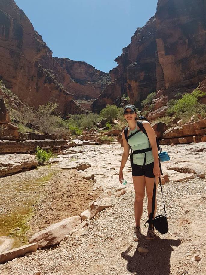
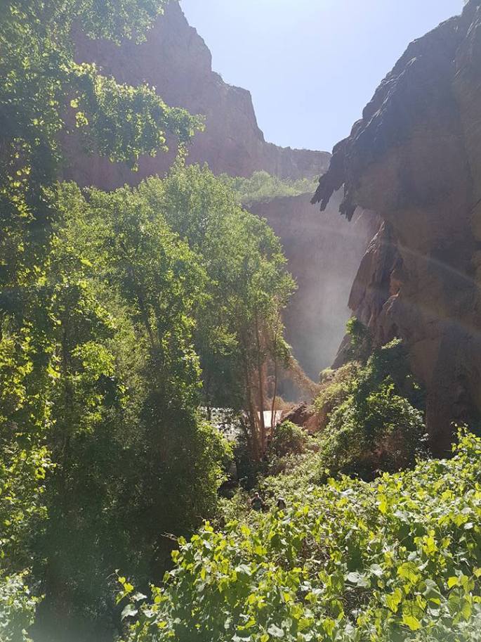
Our second day down there, we hiked down to Mooney Falls (at the end of the campground) and Beaver Falls, 6 miles roundtrip, including quite a scramble down the side of the canyon to get to the base of Mooney Falls (well worth it). If you continue down the trail from Beaver Falls, you will reach the Colorado River, which runs through the Grand Canyon. I think it’s a further 5 miles from Beaver Falls though! The hike down to Beaver Falls feels like you are in Jurassic Park. There is lush, verdant forest and bush with a river running through the middle, and red rock canyon cliffs on either side. It is SO pretty!
The second day down there, we checked out an abandoned mine filled with quartz that’s just behind Havasu, and then most of the group hiked up to Hidden Falls and 50-Foot Falls, then attended a sweat lodge and smudge ceremony, put on by one of the amazing Supai village residents. My legs were SO sore from hiking in flip flops the day before, so I opted to mostly rest by Havasu, enjoy the view, and have another delicious fry bread.
That night, I believe our campsite was the only one that had an amazing song and dance performance put on by a few of the residents of Supai. It was really wonderful.
The next morning, those leaving on the helicopter woke up somewhere around 4 or 5am to hike up to the Supai village to get in line for the helicopter. The rest of us departed two by two between the hours of about 6 and 8AM. The hike out was HARD; our packs felt heavier, we were sad to be leaving, and the ‘slight’ downhill we had on the way in felt like a much steeper incline on the way out. Plus, you end with the 1 mile switchbacks straight back up the Canyon wall. But it felt so amazing to know we did it! And boy did we carb load when we got back to Vegas! 😉
Thanks again to BG Wild, Daniel our guide, Josh, who did set-up, and the amazing group of hikers we got to know!
The Pictures:
Hanging out at Beaver Falls. Some brave folks went jumping off it!There she is! The famous Havasu FallsThe hike in. We are still quite clean. Recommendation: no tank top for the long hike! My pack rubbed my shoulders raw.Nearly to the campground, walking along the river.The scramble down the side of the canyon to get to the base of Mooney FallsLush and lovely! Just after Mooney FallsShoutout to Acuarela Swimwear for my sweet elephant suit! This is the hike from Mooney Falls to Beaver Falls – you cross the river a fair few times.The beautiful valley through which the river and the falls run.
A hopefully useful guide in narrative and list format to help you plan a trip to the ever-popular Iceland! It may be a small place, but it is SO beautiful and diverse. It is definitely on my list of places to return to!
The time of year: good and bad. September is too early for some things like some of the glacier cave walks (I think the one in Snaefellsjokull was open), dog sledding, and really good consistent Aurora (that being said though, about 2 days after we left, they turned off the street lights in Reykjavik because the Aurora was so good that night….), and it does seem to rain quite a bit in late summer/fall.
However, there are fewer tourists, especially as you get off the beaten track, all the roads are still open, and it’s not yet so cold and snowy that you need to bundle up.
Car Rental Company: Blue Car Rentals (bluecarrental.is). We found them professional, friendly, and helpful (although the bathroom at their office could use a good clean!). I think their price is pretty comparable to any other rental company and they are a locally owned and operated company. They often seem to have a ‘rent for 7 nights, get the 8th free’, kind of a deal on.
Driving in Iceland is SUPER easy.
-Lefthand drive (right side of the road like N. America)
-Max speed limit is 90km/hr on the highway
-One main highway looping around the whole island.
-Gas stations – occasionally few and far between as you get further off the ring road, but mostly plentiful.
Between three people, we rented a small, four-door Kia, which was not allowed to go on the ‘F-roads’ (mountain roads) but was quite well suited for the paved and gravel roads we travelled on. For a 10 day trip that circuited the entire island, this was not a problem really to be limited as to the roads we could take, but for anyone staying longer or wanting to do any kind of off- or mountain-roading, such as going to Landmannalaugar, an SUV/4WD capable vehicle would be mandatory. We saw tons of people in the mini camper vans, as well, there is heaps of free camping to be had, so I think next time I would choose to rent an SUV and camp (possibly cheaper) or rent a camper van (these run about $200/day, so not necessarily cheaper at all).
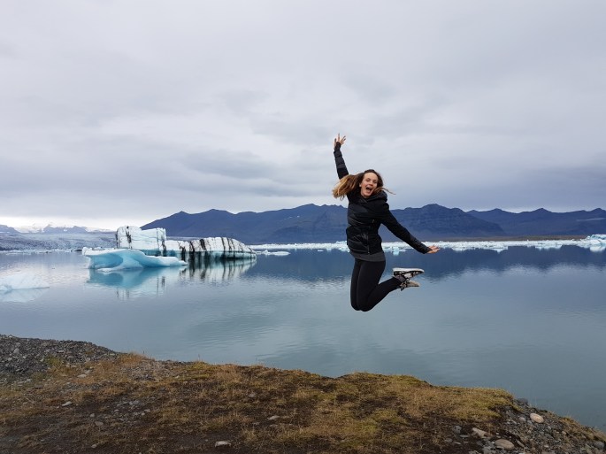
Highlights: Skaftafell National Park, Jokulsarlon Glacier Lagoon, Myvatn Nature Baths, the West Fjords, watching the Northern Lights from a hot tub, the town of Seydisfjordur.
Blue Lagoon first thing in the morning
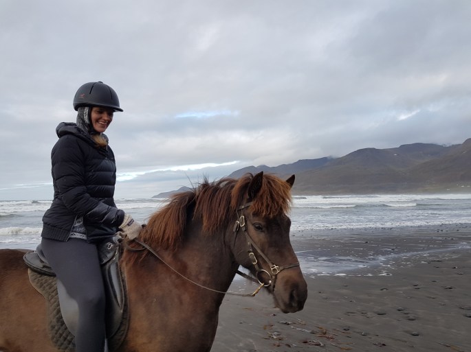
Most Memorable Moment: Riding Icelandic Horses with Lukka and Laki of Langhus Farms (icelandichorse.is) in the late afternoon sun on a beach, with sheep all around….even on the beach, eating seaweed! Heaven.
Riding on a beach in the northern coast region near Akureyri
Must Try: Blue Lagoon including all the different masques, Skyr Yogurt. We did not do it, because it is about $200 Canadian, but on the list for next time is the glacier ice cave experience on Snaefellsness Peninsula.
Cool (literally!) and expensive but once in a lifetime experience: Snorkelling between the tectonic plates at Silfra Fissure in Thingvellir National Park. It’s a cool 4 degrees celcius and the drysuit you get is not for the very claustrophobic, but the water is extremely clear and it’s an otherworldly experience. I would recommend if you are a diver to dive over snorkelling as I think you get a better experience and way more interesting photos!
Most Unique: The Museum of Icelandic Sorcery and Witchcraft in Holmavik, West Fjords. Ever heard of Necropants? Neither had I…..
The beautiful southern coastline at Reynisfjara near Vik.Blue Lagooning
Trip Structure
We fit A LOT into 10 days, but there was quite a lot of driving. Here’s the basic breakdown.
Day 1: We flew over on a red-eye Icelandair flight from Edmonton to Reykjavik and went directly for a soak in the Blue Lagoon, which was perfect. From there we drove to Reykjavik, dropped our stuff and our car and walked around the city centre, which is very walkable, including the famous Hallgrimskirkja, and the architecturally beautiful conference centre. There is lots of shopping to be had, but I would recommend looking around first to see what kind of prices you can get. Surprisingly, museum gift shops often have the best prices in Iceland.
Hallgrimskirkja in the late afternoon light
Day 2: An early morning drive to Thingvellir National Park where we snorkelled in Silfra Fissure with dive.is (GREAT crew, very knowledgeable and safe). From there we carried on to Laugarvatn for lunch at Lindin (http://www.laugarvatn.is/), where we had a really tasty chowder and bun. There is also a hot spring at Fontana there, but it is quite pricey.
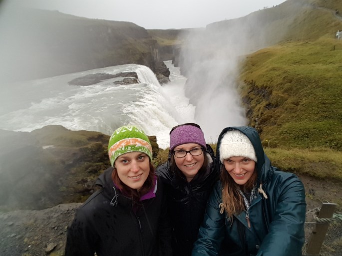
Next up was Geysir and Gullfoss. Geysir was interesting, but if you have been to Yellowstone NP, you may, as I was, be less than impressed in comparison. Gullfoss is beautiful, but it was POURING rain by this point, so we did not stay long.
Accommodation: Super cute cabin in Hella, at Cafe Arhus Hella, right on Hwy 1 heading East. Well worth it.
Getting soaked at Gullfoss
Day 3:
Tally-ho along Hwy 1 to the famous falls at Seljalandsfoss and Skogafoss. There is an amazing fish and chips food truck at Skogafoss. I don’t know if it’s always there but it’s on your right just after you turn left and cross the cattle guard heading into Skogafoss.
Dyrholaey and Reynisfjara, an area of beautiful black sand beach and rock formations near Vik came next. This was one of my favourite stops for sure. This was a LONG drive from Hella to Fosshotel Glacier Lagoon (about 30mins past Skaftafell). Not like, Canadian long, but like, long in the sense that there is a lot to see and do along the way so it’s a pretty packed day.
FYI: the Solheimsandur ‘plane crash site on the beach’ site along the south coast here is featured in many travellers’ photos and blogs/guidebooks. However, due to the farmer who owns the land between the road and the beach placing restrictions on access (due to annoying tourists -__- ), it is no longer easily accessible by car to the public. It’s a flat, boring 4km walk in…and back…. to see some ruined metal on the beach. Granted it’s rather striking looking, but we couldn’t be bothered to waste take the time away from way cooler things. We saw lots of cars parked just off the ring road, so clearly some people still think it’s a worthwhile expedition.
Day 4:
The girls went on a glacier hike at Skaftafell NP, but as I’d been before, I opted to do some hiking around Skaftafell NP instead. I was rewarded with a beautiful vista at Svartifoss, a waterfall surrounded by basalt columns. DEFINITELY recommend. It takes approx 1 hour if you move your butt, but maybe 2 hours at a more leisurely pace. It is well-marked and easy to find, good walking shoes are recommended, and it is free.
Our next stop was the incredible glacier lagoon region, where huge hunks of glacier are breaking off into gorgeous lagoons and slowly making their way into the sea, where they often end up washed up onto the nearby black sand beach. WOW.
Svartifoss
We ended the day with the long but incredibly beautiful drive along the undulous, fjorded coastline up to Seydisfjordur. Here, you can catch the ferry to the Faroes (sadly did not have time for), and enjoy the ridiculously picturesque village and the hiking and waterfalls it has to offer.
Accommodation: Nord Marina Guesthouse. Serviceable but smelled of cat litter box…
Jokulsarlon Glacier Lagoon
Day 5:
Onwards! To Dettifoss, another spectacular waterfall, that often has a rainbow in the mist above it. Recommendation: unless you have a 4WD vehicle, and even then, take the 862 to reach Dettifoss, rather than the far bumpier 864. It will save you lots of time and bumps!
Next to Krafla power station and volanic area. You can walk around the volcanic area, which is really interesting, and see the geothermal power station which looks like it’s on Mars.
After a couple long driving days, we next headed to the Myvatn Nature Baths, a welcome place to soak and replenish, overlooking the gorgeous Lake Myvatn and surrounding countryside. The fee is much less than the Blue Lagoon, although I would say the temperature is much more variable throughout and overall a little less warm.
Jumps at Krafla Volcano
We took a really excellent supper at the Cowshed, just down the road from the nature baths, and had a quick peek at the nearby cave where some Game of Thrones was filmed. Apparently you used to be able to swim in it, but a volcanic eruption resulting in the shift of plates rendered it too hot for human use now.
Accommodation x 2 nights: Guesthouse Storu-Laugar. Great hot tub, nice buffet breakfast, warm and clean rooms, and Icelandic ponies to socialize with!
Day 6:
We were meant to go whale watching but the weather was atrocious and it was cancelled. 😦
Instead, we meandered around Husavik and visited Asbyrgi Canyon, which was a really beautiful little nature preserve.
Asbyrgi Canyon
Day 7: We explored Akureyri after a quick stop at Godafoss and at a traditional turf house dwelling site. It was quite interesting and we marveled at how small people were back then. We were all ducking under doorways, and feeling like giants.
NOTE! In Akureyri, be careful of parking. We got a ticket, even though we had done nothing wrong EXCEPT we didn’t know to set the clock in our car’s front window to the time we had arrived! 😦 Sad face. So be sure if your car has that little clock with moveable hands, to set it to your arrival time. If you don’t have a clock…I don’t know what you would do!
Akureyri is the second biggest city in Iceland and has an interesting church, cute shops, a few delicious cafes, and a yummy ice cream shop called Brynja. Other than that, I don’t think there would be much reason to go there for more than a half day.
Horseback Riding!! We drove north up the peninsula from Akureyri and after several one way tunnels (ah, yes, I forgot to mention there are not only one lane bridges but also one lane tunnels!), we arrived to the picturesque Langhus Farms. Immediately we were welcomed in for tea and cookies and getting to know each other before our ride. Both Lukka and Laki, warm and welcoming people, went to horse university, which is basically my dream, and really do have a wonderful way with their horses. The ride was lovely, the tolt is a truly unique and very comfortable gait, and I definitely wished we could stay there much longer.
We tried to go to an amazing oceanside hotspring at Hofsos after riding, but unfortunately, it was closing for cleaning and then opening again….in an hour! 😦 Will certainly have to try again another time! For future reference it is called Hofsos Sundlaug, and you can’t miss it on the main drag. It has adult only hours at night, for amazing Northern Lights viewing under the stars in the hot tub!
Accommodation: Over a bumpy gravel road and in the middle of what feels like nowhere, lies a wonderful guesthouse, Keldudalur. Situated on a working farm, and featuring two friendly Icelandic Sheepdogs and a hot tub, we enjoyed a super Northern Lights show. There was also a washing machine which was very welcome!
Sunset near Hofsos
Day 8: A relaxation day exploring the area between our guesthouse from the night before and the one for tonight, Giljaland. Just enjoying the scenery and seeing what we could find! We very much enjoyed our host and stay at Giljaland, down at the end of a valley. A man with a great sense of humour and perfect poker face, he recommended things to do in the West Fjords, and we bought Loppi sweaters that his mother in law had knitted. He also made a mean breakfast, including pancakes!
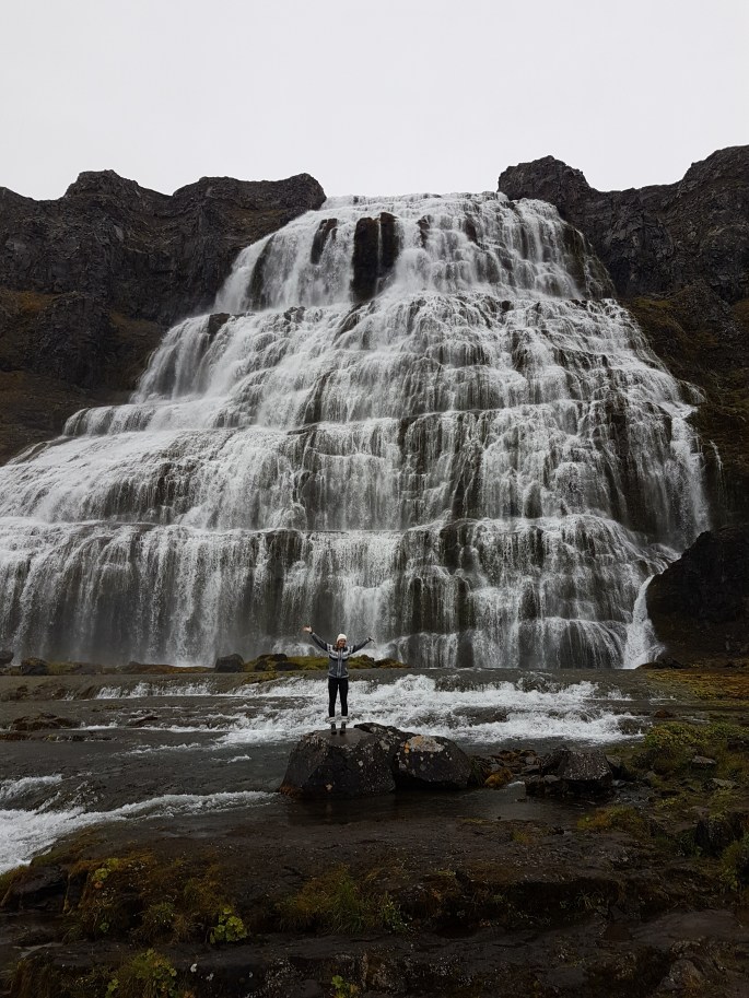
Day 9: West Fjords exploration day, including the Museum of Sorcery and Witchcraft, and a trip over to one of the most stunning and off the beaten track waterfalls, Djandifoss. The West Fjords are beautiful and deserve at least 3 days in their own right, since they are so remote, with extremely windy and often unpaved roads, some of which are only passable in summer. Yet another location to return to on the next trip!
Accommodation: Stora-Vatsnhorn, a tiny wee holiday cottage, which was just perfect for us!
Dynjandifoss
Day 10: Snaefellsness Peninsula. Just go there. No further direction required! 😉
Watch for Dritvik, Djúpalónssandur beach, the coastal walk between Hellnar and Arnarstapi, the zipline at the lighthouse, the mountain you climb in silence to get your wish, and the ever famous . We had only one day there, but I would recommend two.
Rainbow on SnaefellsnesOne of the waterfalls cascading off DynjandifossThe coastal walk between Arnstapi and Hellnar
Accommodation: Fossatun Pods – delightful small pod houses. Although we found the reception man to be very unfriendly, the hot tub closes at 10 (what?!), and the pod houses could use a few design tweaks, overall it was a cute and enjoyable stay. There is a kitchen house for those wishing to do self-serve.
Day 11: Made our way from Fossatun to the airport via a beautiful scenic coastal drive, and a delicious coffee at Reykjavik Roasters, where, I came to find out later, we were served by a member of the new group Krakk and Spaghetti (https://soundcloud.com/krakkogspaghetti). He’s pretty unique, with an awesome fringe and tiny wire framed glasses and was wearing a sweet cat sweater. An awesome end to an awesome trip, either way.
We were picked up early and headed for the Chilean/Bolivian border – there was no time for coffee, although it seemed very much like a hurry up and wait situation! We had ordered from a street vendor by Chilean customs but they seemed to be a one pot operation making the coffee production rather slow. This lead to our driver corralling us back to the bus, before our coffee was ready, sharing sips quickly with the kindly Joost and Janne who had successfully received their coffees but were not allowed to take them on the bus! The vendor of course was quite mad at bus driver, a dramatic shouting match showcasing the expressiveness the South Americans are known for!
We drove up past two volcanoes on our way to the Bolivian border. They are incredibly beautiful and next trip, I hope to be able to climb one of them. The border area….brrrr! Windy and cool! DEFINITELY wish I had packed a few more warm layers! We discovered there were banos all around, when we requested a washroom and the guides just gestured all around them. Grab a piece of tissue and help yourself! >.<
There are fees at the Bolivian border and the national park office, which are typically not covered by the tour providers, so keep some Bolivian money set aside for this.
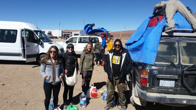
Our guide, Nelson, was excellent. He did not speak a word of English, really, but since the only other male in our group, also named Nelson, was a native Spanish speaker, he was able to translate the important parts for us. We packed into a Toyota 4×4 that Nelson took great care in keeping neat and clean, our luggage strapped up on top and us 6 all sandwiched in cosily. Our group consisted of: me and Ellen, a pair of sisters from Ireland, Niamh and Emer, Nelson from Chile, and his friend Sandra, from Germany.
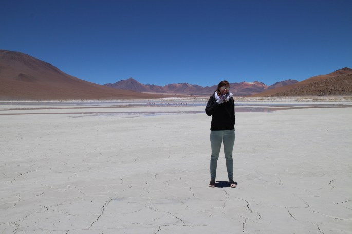
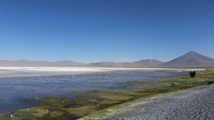
Nelson (our driver) had some excellent music on deck, mainly Bolivian folk-y type music in general, interspersed with a select few 80’s hits. Perfectly surreal to groove to with the surreal scenery around us. We started at Laguna Blanca and Laguna Verde, surrounded by volcanoes. Here, we got our first taste of flamingos. WOW! They are absolutely beautiful birds.
We continued through the moonscape-like desert to the so-called ‘Dali Rocks’. The Irish girls had the brilliant idea of doing running panoramic shots. We would start at one spot while the picture taker slowly panoramed around. As soon as we were out of the shot, we’d run around behind and pose on the other side of the shot just at the camera hit that spot. Doubled! This was super tiring in the decreased oxygen environment but fun. Shortly after this, I discovered that my fingernails looked like the red, white, and blue ice cream cones probably due to the lack of oxygenation. Yikes!
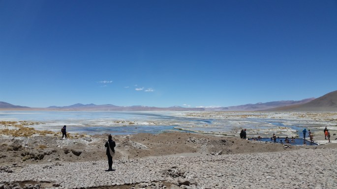
The natural hot springs were the next stop on our tour (also at an additional cost to get in). Ellen and I didn’t go in because of the cold (not wanting to get wet), and the small and crowded nature of the pools, and instead walked around looking at flamingos instead. We were able to get quite close, so surreal! Apparently the hot springs were very nice tho.
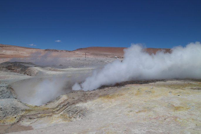
We next took a brief visit to the Geysers, which were not as good as Yellowstone. This was also the highest point in journey (4500m), making it both very cold and tiring. I felt overall pretty good, but just slow. Others in the group were really feeling the altitude.
We had a tasty lunch at the refugio where we were staying for the night once we got there and were then able to take a rest. I got a headache, really my only symptom of being at altitude, apart from being stuffed up, especially when lying down. I took an ibuprofen and that seemed to fix me right up, along with a snack and some water. I was feeling quite lucky to have such mild symptoms at altitude, unlike some of the others who were very headachey, weak, and nauseous.
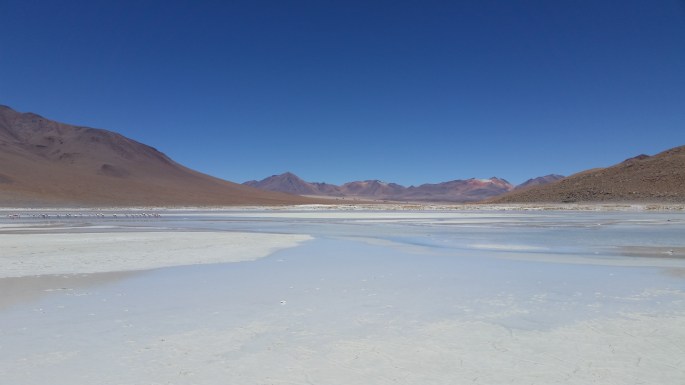
After a brief rest, we set off for Laguna Colorado. It. Was. Amazing. There were SO many flamingos in the waters, eating, sleeping, flying. Plus…there were llamas! Laguna Colorado, means the coloured/red lagoon and indeed, the colours = wow. We were feeling pretty good and took lots of fun photos, pretending to be flamingos, and otherwise goofing off.
Back at the refugio, we tried some coca tea, reputed to aid in altitude acclimatization. I was feeling just fine at altitude, thank goodness! We rested, chatted and then took supper, which was a pretty decent soup and spaghetti. I rallied the group for a birthday song and birthday snickers to Ellen. She made a brief speech, we all cheers-ed her and wished less altitude sickness upon her! ha!
The refugio eating quartersOur beds at the refugio
Our evening was topped off by the stars. Wow. Stupendous! So clear without any interference from city lights, we could see satellites and shooting stars.
I planned out my clothing for the next day, layering being very important. It was not too cold in the sunshine without the wind blowing, but with wind and any decrease in sun, it was quite cold. With all this planning, one of the Germans called me very German! I was touched. Haha! I wanted to do some laundry as my undies situation was starting to reach critical, but after much discussion decided that they may not dry quickly enough and a ‘knickers flag’ clothesline streaming off the car the next morning to dry, may not be appreciated by Nelson y Nelson!
This post is SO LATE! I feel so bad about this particularly because this was such an amazing trip and reminded me again of why I love to go to the States and on roadtrips in particular.
To be honest, I kept putting this off because it was going to be a long post and I need to learn how to be more pithy when I post. Also, I was overwhelmed by the whole 2 weeks and how to condense that into one post. I think that writing it now, 8 whole months after having gone, I’m actually better able to summarize, as I can better pinpoint the highlights, the memorable moments, and the places I would definitely recommend.
June 7-16th, 2015
Creston, BC ->Yellowstone National Park, WY -> Rapid City, SD -> Minneapolis, MN -> Medora, ND -> Browning, MT
This is the first time I’m going to summarize a trip in a single post, rather than day by day. Especially in times when internet is not readily available and days are so jam packed full of stuff to do, it’s hard to write everyday. Plus, who am I to pretend that each day is really that exciting? Particularly when you’re driving up to 10 hours a day…with you, yourself, and your podcasts.
Incidentally, we hosted a couchsurfer last night, and we were talking about roadtrips and how to entertain oneself on roadtrips. Here are a few I listen to on roadies:
Vinyl Cafe with Stuart McLean
Risk
StoryCorps
Ted Radio Hour
Invisibilia
Snap Judgement
Anyhow, Yellowstone! A must! The buffalo and deer roam freely around the park. The sunsets? Insane. I met my friend Liza, who lives now in Denver, CO. We were neighbours and besties in Korea, having many adventures within Korea and abroad. We also have the strange tendency to dress the same, without planning it. I saw her last on my roadtrip with Leah, and it was great to coordinate another meet-up with her.
Within an hour of leaving home, my GPS died…DNR, no CPR, no intubation, nothing would resusc it. I figured out the cable that connected it to my car, supplying it with battery power, had a piece broken off and it wasn’t until I got to Mall of America and a Best Buy in Minneapolis that I would be able to replace it. Luckily, Jeramy, old-fashioned worried BF that he is, had insisted that Leah and I carry a paper roadmap of Canada and the US on our trip across the US. It lives under the passenger seat of my car permanently, so I pulled it out and along with road signs, I was able to continue my navigation.
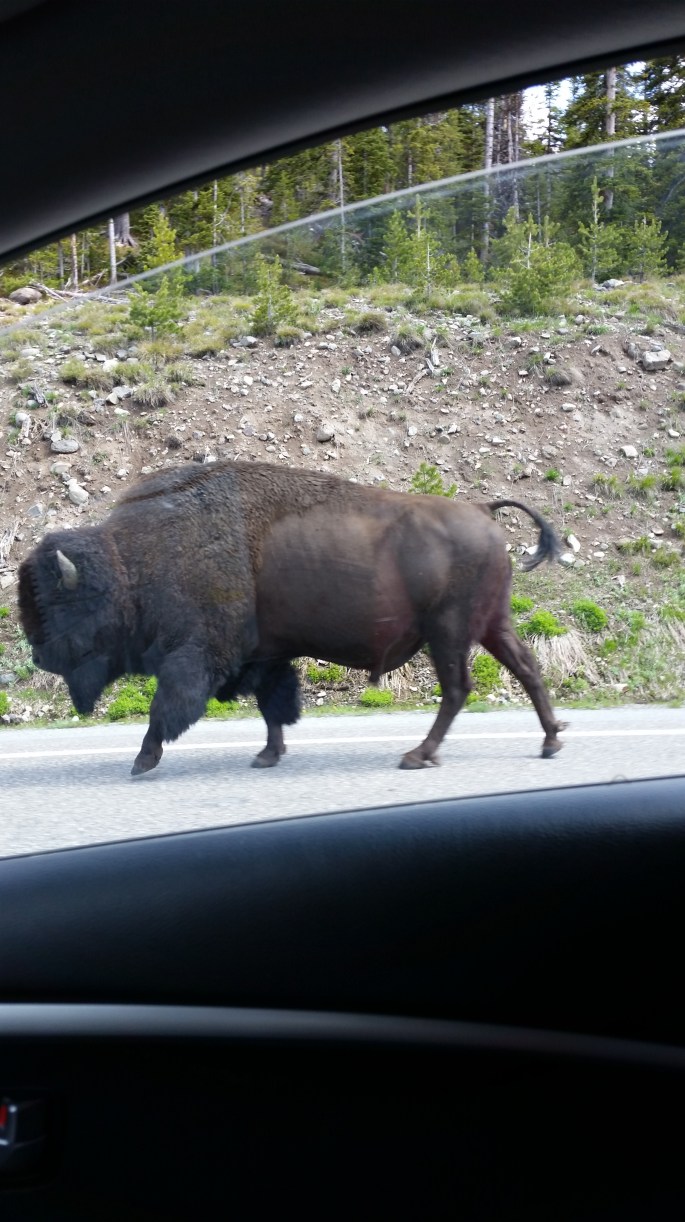
We camped outside the Eastern gate of Yellowstone, at a small campsite, that was largely un-occupied, on a beautiful little site on the river’s edge. The hiking is incredible in this area and we enjoyed a day of hiking up a trail on which we encountered no other humans, forded/fallen-tree-balanced-across 2 overfull creeks, saw evidence of horses, bears, and deer, but only met birds and one deer from far away. From our campsite, we saw the most incredible thunder and lightening storms I have EVER seen, the first night from far off, down at the other end of the valley, and the second night, right in the midst of it, which I still hold clearly in my mind today as simply amazing. Of course, we also had time within Yellowstone Park itself, watching Ol Faithful and the other geysers and mud holes, and the unique and beautiful wildlife. Nothing like passing a buffalo going slow in the right lane first thing in the morning!
Sidenote: I got to use my new mini cam/videocam for the first time! It’s like a GoPro but cheaper…and honestly, gets the job done just fine.
CAMERA
We struggled a bit with lighting a fire the first night (copious amounts of lighter fluid was used, my girl guide mother would be horrified), but we got much better at it by our last night.
CAMERA
There was no shower at our campground, so we ingeniously (we thought) used the sinks at the seldom-used rest-stop just up the road. So fresh! So clean! I don’t know if your standards get lower when travelling, whether you become more creative, and more take me as I am, or what, but just to have clean hair and a quick once over with a proper bit of hot water was all we needed to feel recharged!
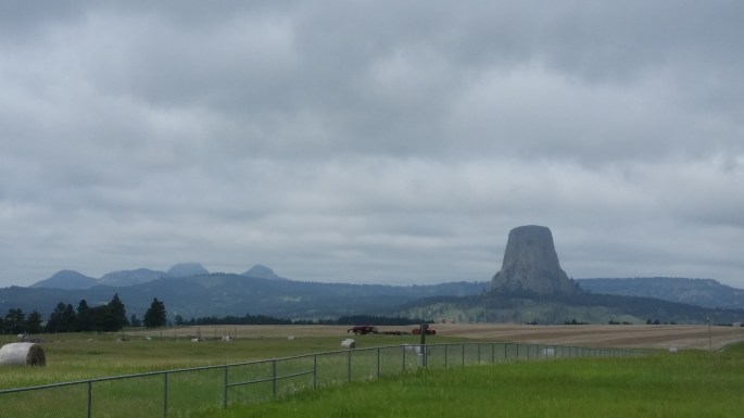
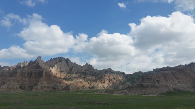
Sunset from our campsiteMt Rushmore!Theodore Roosevelt National ParkDevil’s TowerLooking out over Yellowstone
From Yellowstone, I left Liza and Wyatt (the dog) and moved on alone to Rapid City, South Dakota….still navigating with my trusty roadmap, highway signs, and my sense of direction. Who needs a working GPS anyways?! I went via Devil’s Tower National Monument, popular for rock climbers these days, saw a moose, and had a memorable moment at a gas station in Gillette, when a kindly funeral director helped me check the air pressure on and top up my tires. I have to say, in all my travels in the States, I have only experienced kindness and welcoming, although I do realize that I am a young, white chick!
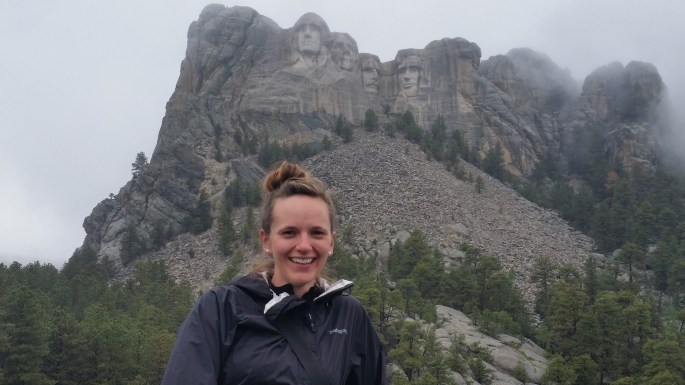
I reached Rapid City, South Dakota that day, ending my day with a quick visit to Mt. Rushmore. I agree that while it seems quite large in photos and in movies, it is really smaller than I anticipated. However, considering when it was carved and the impressive likeness, it is still pretty impressive! I enjoyed the exhibits, and it was very mysterious with lots of fog rolling around the faces.
My bed that night was a Couchsurf, found at the home of a very kindly and well-travelled mother-daughter pair. The mother (over 80 years of age!) had many stories to tell, still sharp as a tack, and looking forward to a trip to Europe with her daughter in a few days. I hope that I am that wise and well-travelled by her age!
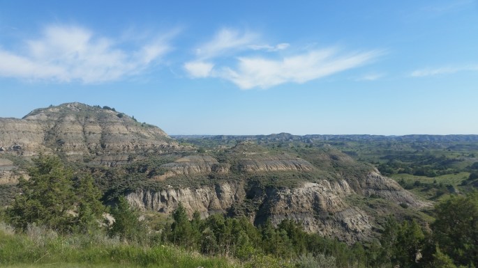
The next day I had a jam-packed schedule set up, with a trip to Wall Drug, a detour through Badlands National Park (very reminiscent of Cappadocia, Turkey), and taking the long way around via a route that to be honest….I can’t recall now! I decided not to stick the main highway though, and boy am I glad I didn’t! The scenery through South Dakota is absolutely stunning: canyons, grasslands, beautiful rock formations – this is the kind of big sky country I could live in! Wall Drug is a fascinating amalgamation of shops, and displays of things like old photos, licence plates, and other memorabilia. It is a great way to break up a drive.
Otherwise, the drive to Minneapolis was flaaaatttttt and straighttttt!! (AKA BORING!) This is where the podcasts come in! I was glad to reach my Airbnb that night for a rest before the wedding of Katie (who I met in Korea) and Brad the next day. Prior to the wedding, I met up with Ilona and Val and their significant others for breakfast and a trip to Mall of America. We had all met while teaching English in Korea, and hadn’t seen each other since then. It was awesome to reconnect and really cool to see the vast expanse that is the ‘American Breakfast’, as well as the Mall of America (huge, has really cool amusement park and giant Lego statues in the middle!). Katie’s wedding itself, beautiful, outdoors, travel-themed reception, lots of dancing, and great fun indeed.
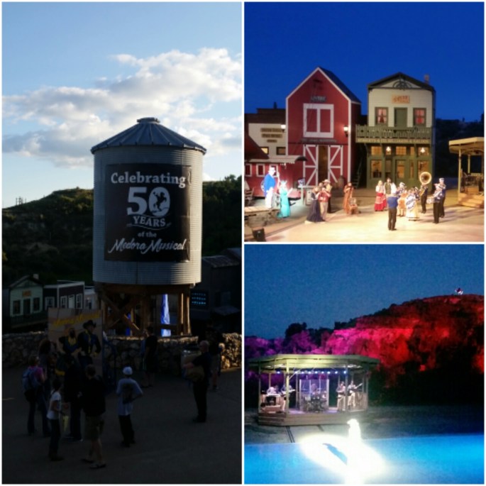
Campsite in MedoraBadlands NPMedora Musical (Awesome)The Korea girls!Tipi Camp in BrowningBadlands NP
After the wedding, I made another big day of driving through North Dakota, to end up in the town of Medora. Medora is home to the Medora Musical, a wonderful open amphitheatre performance including live horses, live music, and a general good time. I very much enjoyed myself. I was able to camp at another campsite right by a river, with very friendly and helpful staff, and a few other campers who were in awe that I would take such a trip all by myself. Honestly, with the pop-up tent (after I figured how to fold the darn thing up), it was SO easy to camp by myself.
Medora is also right across the highway from Theodore Roosevelt National Park. While a small park, it is chock-a-block full of prarie dogs, buffalo, wild horses, and other critters and plant life. The loop road through the park takes only about an hour and a half or so to drive through, and you have to be very careful not to run over (or get run over by) the multitude of prarie dogs and buffalo that inhabit the park!
My last overnight stop was a bit of a splurge, but SO cool. I stayed in Browning, MT, with the hope of taking the Going-To-The-Sun road home (not to be, still closed), at a tipi camp! They supplied bedding on the grass and had set a fire in the little stone fire circle in the middle of the tipi. It was SO cool to light my fire and then fall asleep next to it (yes, I was a bit afraid to light on fire). There was an amazing sunset that night, and the drive home next day was beautiful and sunny, the perfect way to end a wonderful trip!
A few tips for road tripping, since a roadtrip is basically the ONLY was to properly see the US and Canada:
1. Snacks!
2. Wet wipes
3. A roadmap
4. Route planning
5. Take the long way around
6. Reusable cutlery
7. A popup tent so you don’t have to waste time with set-up and take down.
8. Spare blankets for picnics/keeping warm by the fire
9. Tupperware containers (will come in handy for many things)
10. Portable USB charger(s)
I set off in the morning for an adventure to Rainbow Valley, while Ellen rested her sore foot. My group was quite small, just 8 of us, including a very lovely Swiss mother and her grown son. Barbara, the mother, was very talkative, describing herself as a ‘happy retired lady’. She told me that she used to help her dentist hubby when he first opened his practice, though she had no experience as a dental assistant, and she thought every day of divorce during this time, haha! She said when he got a real assistant and she could just do the books, it was much better. When I commented to her that Swiss chocolate is very delicious, she said ‘It’s ok.’!!! A real card, that one.
Our guide was rather talkative, which is always nice. When they are a hand talker and also your driver however…sometimes a bit scary! No, truth be told, I’ve had considerably scarier rides, any city bus at all that I rode in China, for instance. We also picked up a hitchhiker along the way, an older man, who it was translated to me, as an itinerant worker, had been walking for 8 hours to find work.
Yerbas Buenas
Yerbas Buenas is a 7000 year old large amalgamation of rocks/large rock formation. It was originally a place to stay for travellers and now is simply notable for its beautiful petroglyphs. There are many drawings here, many of which tell a story about the times past. They are simply fascinating to look at.
The main face of Yerbas BuenasOne of the mystery pieces – lizard? Rodent?
Our guide delighted in telling us about some of the local plant life as well. The ricarica, good for breastfeeding and digestion, and the pingopingo, from the Ephedrina family, known as the ‘Atacama Viagra’ but good for urinary infection too. Apparently this is no where near as strong as the Chinese strain of the plant, and you should select the fourth section up from where the leaf meets the main stem, as it has the highest concentration of the effective substance in it. He also pointed out a cactus, whose flowers are high in Vitamin C, and were therefore eaten and used to keep scurvy away. This cactus is fondly called ‘the mother-in-law cactus’!
Mother in Law Cactus
Valle Arcoiris: Rainbow Valley
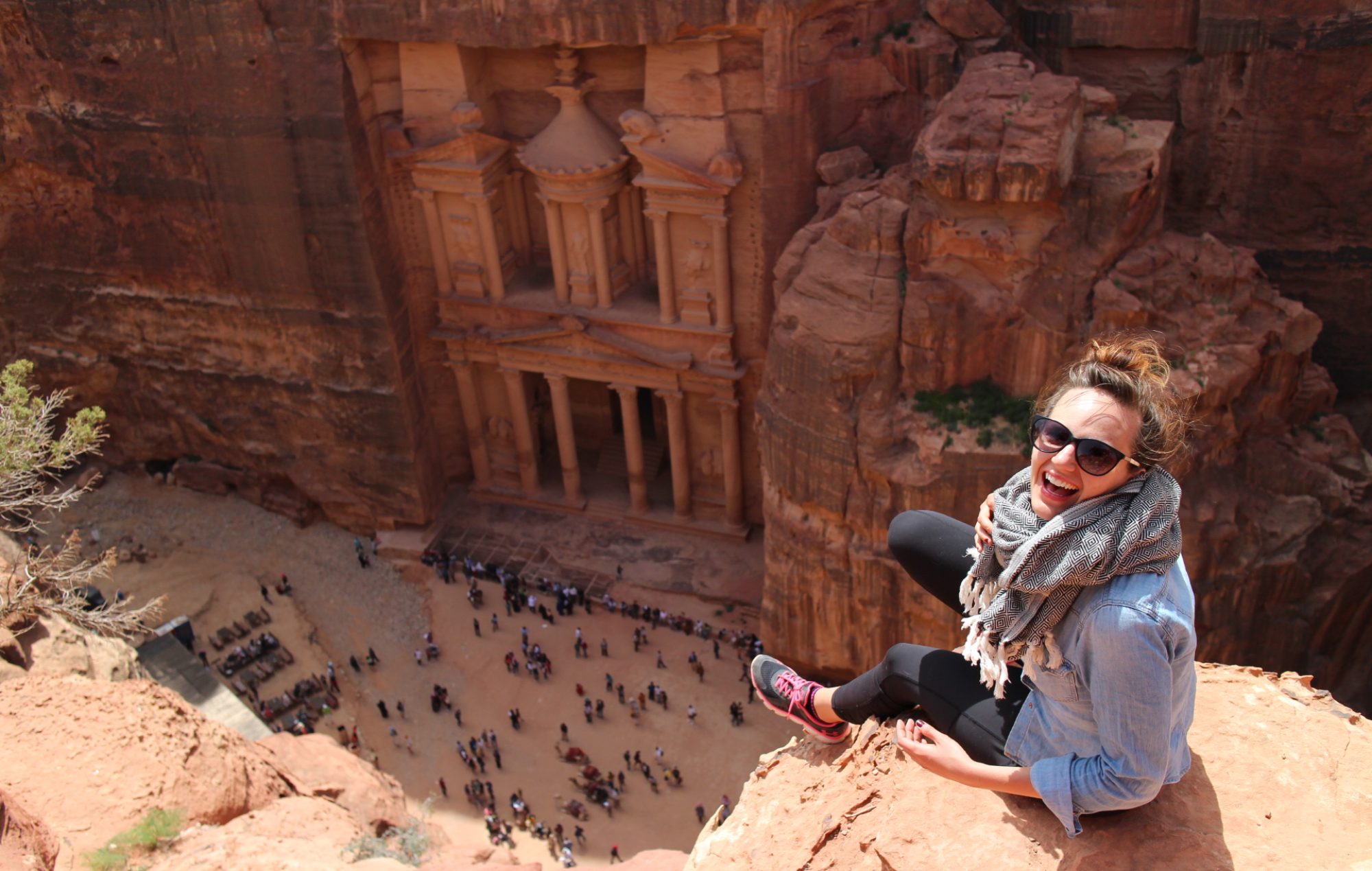
Our next stop was just a short ways down the road. Rainbow Valley, as it is known for the myriad of colour found in the rock, is an estimated 240 million yrs old. Our guide told us that it was originally formed from a magma chamber. The various colours are due to the different minerals in the rock and dirt. We also visited a rock formation that was very reminiscent of Antelope Canyon in Arizona, or the grand entrance to Petra in Jordan, albeit in miniature.
Our Valle Arcoiris GroupCanyon carved by spring floods
Our guide provided us with a snack and we took the opportunity to get to know our group mates a bit better and get into some deep discussion with our guide. He was telling us about how the president of Chile is really ‘just a puppet’ for the 8 families that essentially own all of Chile (business, land, etc). He said that he was originally an architect, but to practice as an architect in Santiago, he would have to work for one of the major companies and just continue to feed into the wealth of the major players. He didn’t want to do this, and so decided to move his family to San Pedro de Atacama, and go as ‘off the grid’ as he could. He said that they power their home with solar panels, don’t have a tv, buy local/organic, send their daughter to an alternate playgroup rather than a government run preschool, and do whatever else they can to make their money count as their vote. I loved this, as it is how I want to live and try to live, and it’s fascinating to see this feeling mirrored on the other side of the world.
Gesturing hand, telling us about the rock formation and colouring 😉
Afternoon: Moon Valley
Our afternoon tour was considerably bigger with a whole busload of people, though we did get to know a lovely Irish couple, who had lived in Vancouver for a few months. It’s truly a small world.
Our first stop was the 3 Marias, although now technically known as the 2 1/2 Marias. It was originally also used as a resting place. The reason they are now the 2 1/2 Marias is because a few years back a tourist stood on one of them and broke it off. We asked what had happened to the tourist who broke it, thinking it would have been a huge fine and deportation for sure, but he received only a 100 dollar fine!
I’m the 3rd Maria/Death glare at the people encroaching on my photo.
We climbed up a steep slope to the to top of Achachas, a sand dune/rock formation. What a beautiful 360 view! Our very funny guide Simon told us volcano story about the two brother volcanoes Licancabur and Juriques, who stand side by side. Licancabur is the ‘perfect’ volcano, with symmetrically sloped conical sides. Juriques, on the other hand, appears to have been lopped off in the middle, and to the other side of Juriques is an empty spot, exactly mirrored across the valley with a ‘female’ volcano, Quimal. Quimal was supposedly Licancabur’s girlfriend/fiancee, originally located on the same side of the valley as the other two. When Juriques began flirting with her, the father volcano down the valley, Laskar, erupted in anger and chopped Juriques’ head off and moved Quimal across the valley from the boys. A cautionary tale on the dangers of promiscuity to be sure!
Licancabur and Juriques visible in the distance
Conquerors of the small hill
After a quick exploration of a cave, studded with mineral crystals, we headed back to town for a well deserved rest!
Tips for exploring San Pedro de Atacama region:
1. Light layers.
2. Good footwear.
3. Water. Lots.
4. SPF 60.
5. Headlamp for exploring caves.
6. Scarf for when the wind is throwing sand in your hair and eyes and also for when it gets cold at sunset.
7. Snack although there are empanadas and water at the main entrance of Moon Valley if needed. I don’t think other destinations like the lagunas and Valle Arcoiris have snacks though.
8. Travel with a locally owned/eco-conscious tour company